How Photogrammetry Can Aid Ecosystem Conservation Efforts
Photogrammetry captures complex environments by integrating precise stop-motion digital images into 2D and 3D software models. These models provide a robust depth of interactive data, enabling users to both re-create and determine new potential outcomes in a wide variety of environments. Photogrammetric data models are used extensively across several industries including architectural design, meteorology, transportation, topographic mapping, archaeology, Film CGI and video game production.
Uniquely, photogrammetry delivers accurate measurements that work in balance to maintain the spatial integrity of a captured environment while it is being manipulated. In application, photogrammetry can assist meteorologists in determining blizzard outcomes, enable automotive engineers to accurately weigh the collision impact contributions in accidents and help archeologists accurately re-create the structures of past civilizations. For Ohio University grad student Jorge Castillo, photogrammetry provides the means to preserve whole ecosystems both through modeling analysis and, equally as important, visual education.
Originally from Ecuador, Castillo’s undergraduate passion was grounded in his country’s rich biosphere; he obtained his biology degree from Pontificia Universidad Católica del Ecuador (PUCE). From there, Castillo came to Ohio University where he completed an M.A. in Photography and is working toward his MFA in Communications and Media Arts.
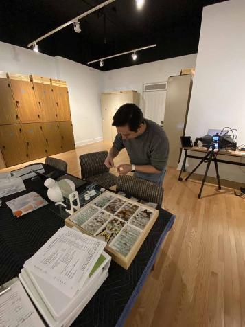
As a Naturalist, Castillo believes that it is imperative to facilitate inclusivity to experiencing the biology of the planet we share. Not every student can access a hands-on learning “Eco experience.” To help remove those barriers, Castillo’s current photogrammetry work is being accumulated into an open-source Frame AI platform, enabling any users to access means to create 3D augmented reality experiences in bio-habitats for educational studies. For a single 3D map of a biological specimen, Castillo took over two hundred digital photographs to integrate into photogrammetry’s software.
For ecological education, photogrammetry provides a meaningful opportunity for insight on current conservation efforts and environmental dilemmas. Castillo’s work has been featured in National Geographic and BBC Wildlife Magazine, and he was a contributor to the Yasuni National Parks visual storytelling exhibition, which highlighted the park’s natural wonders, cultures, and conservation threats.
Utilizing photogrammetry to educate students about endangered species continues to be a vital focus in Castillo’s projects. Castillo’s current photogrammetry work is concentrated in Crane Hollow Nature Preserve in nearby Hocking County. The preserve encompasses nearly 2,000 acres of protected, and rare, plants and animals through the Ohio Department of Natural Resources Division of Natural Areas to ensure ecological integrity.
The McClure School of Emerging Communication Technologies strives to offer the best academic programs in the IT (Information Technology), the game development and the Virtual Reality/Augmented Reality (VR/AR) industries. Our programs and certificates cover numerous aspects of the rapidly changing industries of information networking, cybersecurity, data privacy, game development, digital animation and the academic side of esports.