How a master's in Geological Sciences turns field data into career opportunities
Explore geology career paths in environmental consulting, resource management, and government. See how OHIO’s online M.S. builds field, GIS, data, and writing skills.
June 30, 2026
Share:
Geology careers are evolving fast, and the numbers back it up. The U.S. Bureau of Labor Statistics projects steady demand for geoscientists and environmental specialists, with thousands of openings each year driven by needs in energy, water, infrastructure, and environmental protection. Employers still need professionals who understand rocks, water, landforms, and earth systems, and they increasingly expect those professionals to translate field data into clear maps, models, and actionable reports.
That shift means today’s roles in geology call for four practical, job-ready skills: field data collection, GIS software, geodata analysis, and technical writing.
Ohio University’s online Master of Science in Geological Sciences is built around this kind of applied learning. The program is 100% online, non-thesis, 30 credits, and designed for working professionals and teachers. Students can also add an online GIS & Cartography certificate to build stronger geospatial skills.
For students who want to work in environmental consulting, resource management, government agencies, or related fields, the goal is to graduate with skills that can be demonstrated in real time.
What geology career paths can a master’s degree support?
A master’s in geological sciences can support many career paths. Some are field-based. Some are lab-based. Many combine fieldwork, data analysis, mapping, and writing. Graduates may prepare for roles such as environmental consultant, environmental geologist, hydrogeologist, GIS or geospatial analyst, resource management specialist, government geologist, earth science educator, or geoscience project specialist.
These roles often focus on real problems. A geologist may study groundwater, map flood risk, review land use, test soil or water, or explain hazards to clients and public agencies.
The U.S. Bureau of Labor Statistics projects employment for geoscientists to grow 3% from 2024 to 2034, with about 2,000 openings each year. For environmental scientists and specialists, BLS projects 4% growth and about 8,500 openings each year.
The work also fits well with public service. The U.S. Department of the Interior lists geology work that includes collecting and evaluating geologic data, managing databases, preparing reports, presenting technical information, and conducting surface and subsurface field investigations.
What skills do geology employers look for?
Employers want geologists who can move from data to decisions. That means graduates need more than course knowledge. They need proof that they can solve problems.
Four skills stand out:
- Field data collection: gathering useful information from a site, stream, aquifer, well, map, or sample.
- GIS software mastery: using tools like ArcGIS Pro to map, manage, and analyze location-based data.
- Quantitative geodata analysis: using numbers, models, and statistics to study patterns in earth data.
- Technical writing: turning findings into reports, maps, memos, and recommendations.
O*NET names geoscientist tasks such as preparing geological maps, cross sections, charts, and reports using fieldwork or lab research. It also lists communication of findings as a core part of the job.
That is why a strong geology program should help students build a portfolio. A portfolio can show employers what a student can do with data, maps, and reports.
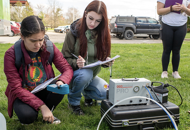
Why does field data collection matter in geology careers?
Field data is the starting point for many geology jobs. In environmental consulting, this data may include soil samples, groundwater levels, stream measurements, site photos, drilling logs, or field notes. In resource management, it may include watershed data, surface features, subsurface data, or geologic maps. In government work, it may support decisions about land use, hazards, minerals, water, or environmental risk.
Good field data helps geologists answer practical questions. They may need to know whether groundwater is moving toward a sensitive area, where erosion risk is higher, what the subsurface looks like, or whether a site is safe for development. They may also need to explain what natural resources need protection and what risks a client or agency should understand.
OHIO’s online geology curriculum includes courses that connect to this kind of work. GEOL 5700: Groundwater Fundamentals and Practices covers groundwater movement, storage, contamination, remediation, aquifers, well hydraulics, and hydrogeologic investigations. GEOL 5750: Watershed and Stream Hydrology covers watershed processes, water budgets, flow paths, streamflow, flood frequency, surface water and groundwater exchange, and hydrologic modeling.
This is important because field data does not stand alone. It has to be organized, mapped, analyzed, and explained. That is where GIS and geodata skills become important.
What GIS skills do geology employers look for?
GIS stands for geographic information systems. It is software used to manage, map, and analyze location-based data.
In geology careers, GIS helps professionals see patterns that may not be clear in a spreadsheet. For example, GIS can help show where flooding may occur, how a contaminant plume may move, where stream erosion is more likely, or how land use overlaps with natural hazards.
Employers often look for GIS skills such as building clear map layers, managing geospatial data, creating data tables and map products, using spatial analysis tools, building 2D and 3D visualizations, and designing maps for reports or presentations. These skills help geologists share findings with teams, clients, and agencies.
O*NET lists GIS tasks that include producing data layers, maps, tables, and reports; preparing graphic displays of GIS data; and maintaining GIS databases.
OHIO students can strengthen these skills through the online GIS & Cartography certificate. The certificate is fully online, 12 credits, and designed for recent college graduates and working professionals, including people without prior GIS or cartography experience. Required courses include GEOG 5730: Principles of GIS, GEOG 5600: Cartography I, and GEOG 5610: Cartography II.
The certificate learning outcomes also match what many employers need. Students learn practical GIS software skills for mapping, database management, geospatial analysis, map design, and web mapping.
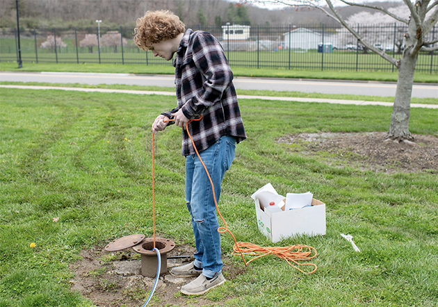
A geology student collects field data using equipment lowered into a ground opening.
How does ArcGIS Pro help geologists turn data into decisions?
ArcGIS Pro is Esri’s desktop GIS software for mapping, data management, and spatial analysis. It supports 2D, 3D, and time-aware data, and it can be used for spatial analysis, data science workflows, imagery analysis, and sharing maps or data through ArcGIS systems.
For geology students, ArcGIS Pro is important because it helps turn earth data into useful visual evidence. A geologist may use it to map groundwater levels, model surface features, compare sample locations, study spatial patterns, or prepare figures for a technical report.
ArcGIS Pro is a part of GEOL 5060: Geodata Analysis. In this course, students learn surface and subsurface 2D and 3D visualization, geospatial data organization, exploratory data analysis, correlation and regression, spatial interpolation, spatial modeling, and uncertainty analysis. Students also use ArcGIS Pro and Petrel to produce surface and subsurface data visualizations and analyze data.
This gives students practice with the type of work they may need to show an employer: that they used GIS to solve a geological or environmental problem.
Why is quantitative geodata analysis important for geology jobs?
Geodata analysis helps geologists make sense of large and complex data sets. A geologist may need to compare groundwater levels over time, study streamflow patterns, model a subsurface surface, or check how reliable a data pattern is. These tasks require numbers, maps, and judgment.
Quantitative geodata analysis can help answer questions about where risk is highest, what pattern appears in the data, how certain a model is, and what should be sampled next. It can also help geologists see what a map shows that raw data does not.
OHIO’s GEOL 5060: Geodata Analysis is built around these skills. The course includes geospatial data preparation, exploratory data analysis, correlation and regression, spatial interpolation, modeling, uncertainty analysis, and real-world geological or environmental problems.
Why is technical writing important for environmental geologists?
Technical writing is one of the most important skills in geology. A field visit, lab result, map, or model has limited value if no one can understand it. Clients, engineers, public agencies, and project teams need clear reports. They need to know what was found, how it was found, what it means, and what should happen next.
Environmental scientists and specialists often collect and analyze data, then recommend action. In geology careers, technical writing may include environmental site reports, groundwater summaries, watershed studies, geologic maps, cross sections, risk summaries, client memos, permit support documents, government reports, and project recommendations.
OHIO’s curriculum supports this skill through applied courses and a required research and technical skills portfolio. Students must complete a portfolio that is designed to assess how well they synthesize knowledge from the program.
That portfolio can become a practical career tool. It can show that a student can gather information, analyze it, build maps or models, and explain results in writing.
How does OHIO’s online M.S. turn skills into a professional portfolio?
A strong portfolio shows what a student can do. OHIO’s online Master of Science in Geological Sciences includes a research and technical skills portfolio as the culminating experience. This portfolio is designed to assess the student’s ability to bring together knowledge from the program.
For career-focused students, that portfolio can be framed around the four skills employers value. It may show how data was gathered, selected, cleaned, or prepared. It may include maps, layers, visualizations, or spatial models made with tools such as ArcGIS Pro. It may also include charts, models, uncertainty analysis, spatial interpolation, or other data-driven results.
The writing side can be displayed in a portfolio too. A strong portfolio should include a report, memo, or project summary that explains the problem, method, findings, and recommendation. This gives employers evidence that a graduate can step into a job site, lab, office, or agency setting and contribute.
How can the GIS certificate strengthen career preparation?
The online GIS & Cartography certificate can make the geology master’s stronger for students who want roles that involve mapping, spatial data, and visual communication.
The certificate teaches students how to think spatially, interpret maps, and use geospatial technologies. OHIO states that, after completing the certificate, students should be able to complete mapping and geospatial analysis tasks used in many fields.
This can help students prepare for roles such as GIS analyst, environmental GIS specialist, mapping technician, resource management analyst, geospatial project specialist, or environmental consultant with GIS duties.
The certificate also helps students make stronger portfolio pieces. A clear map, a well-built GIS layer, or a web map can help show employers that a student can communicate data visually.
Is an online geology master’s a good fit for working professionals?
An online geology master’s can be a strong fit for adults who need flexibility.
OHIO’s online M.S. in Geological Sciences is designed for working professionals and teachers. The program uses seven-week courses, requires no GRE, has no thesis, and can be completed in as little as three semesters.
All coursework is entirely online and no campus visits are required.
That format can help students keep working while they build new skills. It may also help career changers or current science educators gain stronger geology, GIS, and data skills without leaving their jobs.
What should students look for in a career-focused geology program?
Students who want to work in environmental consulting, resource management, government, or GIS should look for a program besides lectures.
A career-focused geology program should include applied geology courses, groundwater or hydrology content, GIS training, ArcGIS Pro or similar industry software, quantitative data analysis, map and model creation, technical writing practice, a final project or portfolio, and flexible online options for working adults.
OHIO’s online M.S. in Geological Sciences connects many of these areas. The program offers applied earth science training, online coursework, geodata analysis, hydrology courses, an optional GIS certificate, and a final research and technical skills portfolio.
The bottom line: Geology careers need proof of skill
Geology careers are built on evidence. The same is true for career preparation.
Employers want to know that graduates can collect useful data, use modern GIS tools, analyze geodata, and write clear reports. These skills are important in environmental consulting, resource management, government work, and many geospatial roles.
Ohio University’s online Master of Science in Geological Sciences helps students build that proof. Through applied courses, GEOL 5060: Geodata Analysis, ArcGIS Pro training, hydrology coursework, the optional GIS & Cartography certificate, and a final research and technical skills portfolio, students can turn online learning into work they can show.
For students who want to move into geology careers with practical evidence of what they can do, that portfolio may be the bridge between a degree and the next role.