Image
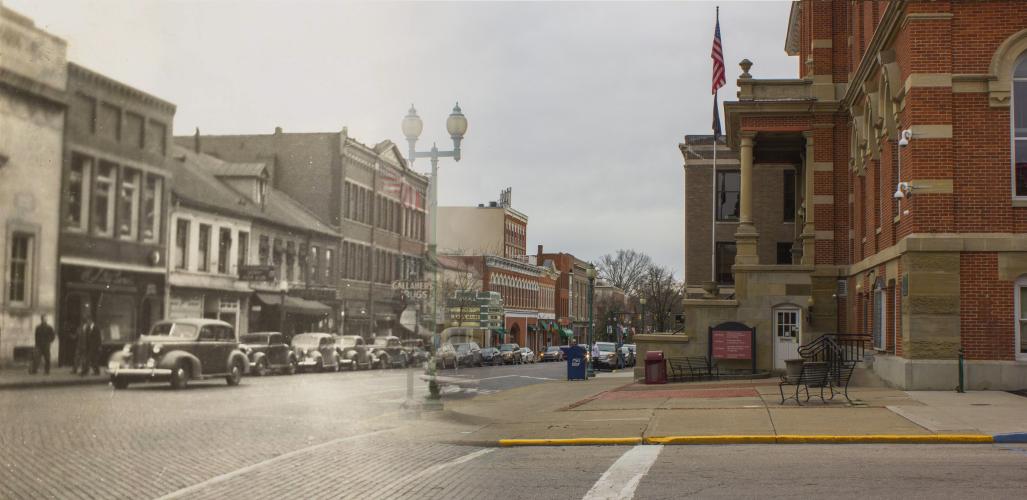
An image from “Mapping the Historical Range Books of W. E. Peters: An Exploration of Athens County, Ohio Past and Present.”
Ohio University Libraries is looking into the past and showcasing the works of William Edward Peters, a civil engineer, land surveyor, lawyer, author and genealogist who published many works about the state of Ohio and Athens County. In the W.E. Peters Papers archival collection, Peters’ surveying and drafting skills are featured with his photos and documentation of Southeast Ohio.
In both a digital and in-person format, the exhibit, “Mapping the Historical Range Books of W. E. Peters: An Exploration of Athens County, Ohio Past and Present,” provokes the idea of wanting to document history and making sure not to forget or lose what things used to be. The physical exhibit will take place on Alden Library’s fifth floor from Feb. 6 to May 5 while the online exhibit is accessible through Story Maps.
After moving to Athens County in the 1880s, Peters dedicated his life to studying and documenting the region, a pursuit which continued through the 1940s. The exhibit showcases Peters' local history research included in the personal papers he donated to the Ohio University Libraries, which are now held in the Mahn Center for Archives and Special Collections.
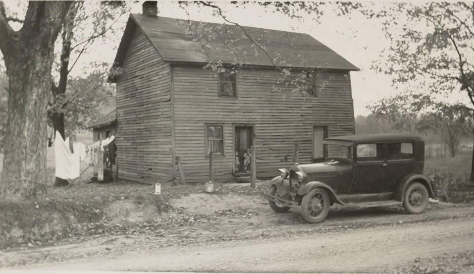
Erin Wilson, digital imagining specialist and lab manager for University Libraries, mentioned in an email that the in-person exhibit displays pages from Peters’ “Range Books” which are photographic scrapbooks that go in-depth about the county and document its unique aspects.
“They [the Range Books] present a very important record of Peters’ place and time, as many of the sites he visited were at risk of disappearing,” Wilson wrote. “Examples include schoolhouses and other instances of vernacular architecture, ancient earthworks created by Native Americans and small family cemeteries.”
Locations mentioned in the physical exhibit have QR codes that visitors can scan to view them in an interactive map that goes along with the exhibit. The online map can be used to explore sites Peters documented in the 1930s and 1940s, while the digital exhibit includes additional content related to Peters’ legacy.
“Thanks to the very focused efforts of student employees who assisted with the project, we’re excited to launch the public map with the exhibit,” Wilson wrote. “It contains over 500 historical features in Athens County that were documented by Peters and invites users to contribute additional details, comments or their own photos. The map is compatible with mobile devices so it can be used for on-site field exploration.”
Sarah Romer, a senior studying wildlife and conservation biology, is one of the student employees assisting with the exhibit and collection. As a digital initiatives assistant, Romer has been working almost exclusively with the W.E. Peters Papers and has been geolocating features from Peters’ Range Books.
“Peters’ 26 Range Books contain pictures of places and objects that he believed had historical or cultural significance to the region, many of which were disappearing in the rapidly changing world of the early – mid 1900s,” Romer wrote. “My job was to look at the pictures Peters took and locate where they actually were.”
With so much content and history displayed for both the in-person and online exhibit, it will definitely be worth checking out.
“W. E. Peters truly loved Athens County and the people in it, so hopefully visitors can get a sense of the person behind all of this as well,” Romer wrote.
For more information, visit the exhibition website or contact Wilson at wilsone5@ohio.edu.